
Top 7 Geospatial Data Search Engines in 2024
 Parker Dinkins
In the realm of geospatial analysis, finding the right data quickly and efficiently is often the biggest hurdle. The vast amount of geospatial data available can be overwhelming, and sifting through multiple sources to find the exact dataset you need can be time-consuming and frustrating.
This is where geospatial data search engines (GDSEs) come in. These comprehensive geospatial data platforms streamline the data discovery process, providing centralized access to a plethora of geospatial datasets, saving users valuable time and effort.
Here are the top 7 geospatial data search engines for 2024 that are revolutionizing how we access and integrate geospatial data through advanced geospatial data services and management systems.
#1 GISDATA.io Galileo
750,000 ArcGIS Datasets
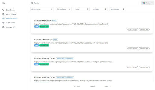
GISDATA.io Galileo stands out as an industry-leading geospatial data search engine with 750k datasets from thousands of sources. Users can quickly make searches, apply filters to narrow their searches, and preview the data all in a matter of seconds. Soon, users will be able to download the data or sync it directly into their own databases, thanks to the efficient geospatial data management. GISDATA.io also offers developers direct access to the API that powers their search engine for use in their own applications, making it a robust geospatial server for data delivery.
Key Features:
- 750k ArcGIS Datasets
- Instant Data Previews
- Data Downloading and Database Syncing
- Developer API
Pros:
- Extensive dataset collection
- Fast and intuitive search functionality
- User-friendly interface with single-tab experience
- API access for developers
- Unparalleled Support and ability to request features
Cons:
- Team and Enterprise features still in development
- Primarily focuses on US datasets currently (expanding daily!)
Price:
- Free to search with limited results.
- Students and Professors get free access to the Starter Tier.
- Starter Tier: $5/month for unlimited results and advanced filters.
#2 GeoSeer.net
517,000 ESRI ArcGIS Datasets, 3.5m OGC Datasets
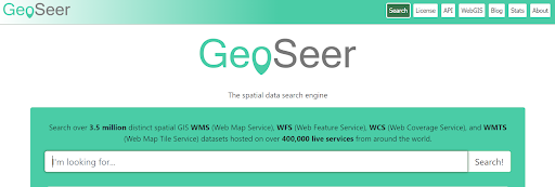
Geoseer.net is the industry leader for OGC datasets, boasting over 3.5 million datasets from all over the world. Geoseer.net offers a licensed version of their database for research, internal, and public commercial uses. Additionally, Geoseer.net provides a developer API with spatial searching capabilities, making it a treasure trove for those seeking Web Map Service (WMS), Web Feature Service (WFS), and Web Coverage Service (WCS) among other live services.
Key Features:
- 3.5m OGC Datasets
- Database Licenses
- Developer API
Pros:
- Largest collection of OGC datasets
- Comprehensive spatial searching capabilities
- Multiple licensing options for different use cases
Cons:
- High cost for API access
- User interface less intuitive compared to competitors
Price:
- Free to search
- Licensing costs depend on use case
- API: Startup for £65/mo, Professional for £195/mo, and custom Enterprise pricing
#3 Data.gov
295,000 Datasets
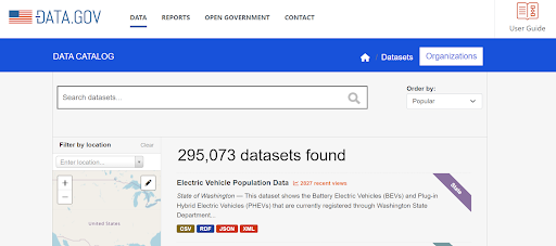
Data.gov is a United States Federal Government project that houses 295k datasets. While some of the datasets are in geospatial formats, it also contains CSVs, PDFs, JSON, TIFFs, HTML, and many more formats. The platform, a key player in the Open Government initiative, has filters for formats, publishers, organizations, and categories, mostly containing data from US Federal agencies. It stands as a pivotal geospatial platform for discovering federal geospatial data, supported by the Federal Geographic Data Committee (FGDC).
Key Features:
- US Federal Agency Datasets
- Multiple Data Formats
Pros:
- Extensive range of data formats
- Free to use
- Strong focus on transparency and open government
Cons:
- Not exclusively geospatial data
- Limited advanced search capabilities
Price:
- Free to search
#4 GeoPlatform.gov
182,000 Datasets
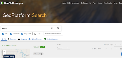
GeoPlatform.gov is another United States Federal Government project that has 182k datasets, exclusively in geospatial formats. The platform, which is part of the National Geospatial Data Assets (NGDA) Management Plan, has filters for types, agency, topic, and status, containing mostly data from US Federal agencies. GeoPlatform.gov, supported by GeoPlatform ArcGIS Online and the GeoPlatform Knowledge Base, serves as a cornerstone for geospatial metadata and data discovery.
Key Features:
- US Federal Agency Datasets
- Geospatial Data Formats
Pros:
- Focus on geospatial data
- Free to use
- Comprehensive metadata and filtering options
Cons:
- Primarily US-centric
- User interface could be more user-friendly
Price:
- Free to search
#5 ArcGIS Hub
123,000 Datasets
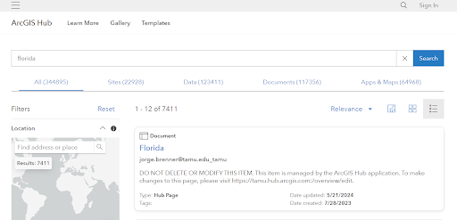
ArcGIS Hub, created by ESRI, the creator of the popular GIS software ArcGIS, is their platform for discovering datasets hosted on ArcGIS servers. ArcGIS Hub contains 123k datasets with filters for categories, licenses, tags, sources, and types. You can click on the datasets and launch a preview of the data and download it, if supported, making it an essential tool for geospatial applications and data collaboration.
Key Features:
- ArcGIS Server Data Sharing and Management
Pros:
- Seamless integration with ArcGIS products
- Comprehensive data previews
- Robust filtering options
Cons:
- Requires ArcGIS Online subscription for publishing
- Limited to ESRI-hosted datasets
Price:
- Free to search
- Publishing requires ESRI ArcGIS Online Subscription
#6 Koordinates
21,000 Datasets
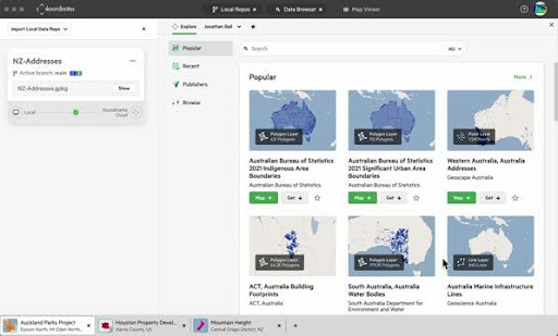
Koordinates is known for building software for managing and sharing geospatial data in the cloud. They also have a search engine with 21k datasets where users can find data and view it in a map on the left side of the screen. Users can add and visualize multiple datasets while searching all in the same window, with filters by region, type, publisher, date, and license, showcasing the power of cloud-computing in geospatial data discovery.
Key Features:
- Data Previews
- Map Sharing
Pros:
- Intuitive map-based search interface
- Supports multiple dataset visualizations
- Cloud-based data management
Cons:
- Smaller dataset collection
- Higher cost for organization data management
Price:
- Free to search
- Organization Data Management Platform is $779/month
#7 ESRI Living Atlas
7,200 Datasets
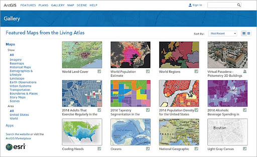
ESRI Living Atlas is a curated collection of datasets and online applications. ESRI Living Atlas contains 7.2k datasets that users can search for and filter by category, type, time, and region, embodying the FAIR Principles and contributing to the National Spatial Data Infrastructure with its comprehensive and accessible geospatial resources.
Key Features:
- Curated Categories
- User Published Datasets and Applications
Pros:
- High-quality curated datasets
- Strong community and user contributions
- Integrates well with ESRI products
Cons:
- Smaller dataset collection compared to competitors
- Requires ArcGIS Online subscription for publishing
Price:
- Free to search
- Publishing requires ESRI ArcGIS Online Subscription
Summary
Each of these geospatial data search engines offers unique strengths and features tailored to different needs in the geospatial community. GISDATA.io Galileo stands out with its vast dataset collection, instant data previews, and upcoming features for data downloading and syncing, making it a powerful tool for anyone needing comprehensive and fast access to geospatial data.
GeoSeer.net leads in OGC datasets, while platforms like Data.gov and GeoPlatform.gov provide extensive datasets from US Federal Agencies. ArcGIS Hub, Koordinates, and ESRI Living Atlas offer specialized tools and curated collections that cater to various professional and research needs.
Together, these platforms represent the best in geospatial data discovery and integration for 2024, making them indispensable for anyone working with GIS data, spatial GIS, or in need of geographically enriched data.